International Committee for Crimea
Arabat Spit
|
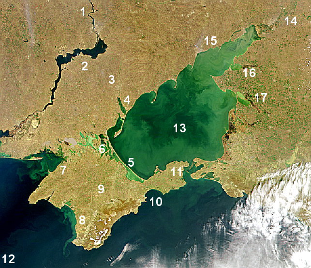
Map of Azov Sea. No. 9 marks Crimea and No. 5 is the Arabat Spit |
It is difficult to believe that a narrow strip of land that lies to the northeast of the Crimean peninsula was the scene of a horrendous crime during WWII. The Arabat Spit was barely populated in 1944, when the remaining group of Crimean Tatar villagers were rounded up and drowned in the Azov Sea. A sandbar slightly over 100 km long, Arabat today remains a quiet place with beaches and health resorts. The name "Arabat" is derived from Arabic, meaning a military post and no doubt related to the Arabat Fortress built by the Ottoman Turks in the 17the century. A barrier island with no fresh water, the Arabat Spit was a wild area until the mid 19th century when Russian government built a road and several posts.
*For additional information about the above map and the Arabat Spit, see the related Wikipedia article.
Back to: Introduction to the Arabat Tragedy Series.
Posted: 26 December 2012